Click here for the Glossary page
Click here for the main index of the Burton Latimer Heritage Society site
Click here to return to the previous page
Written by John and Jan Meads

Burton Latimer 1881 Census

Introduction


Edward Quincey in 1857
The 1881 Census was the fourth since the 1841 census began naming all the inhabitants of each village and town.  

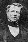
Although he does not appear himself in the census, Edward Quincey is again named the enumerator. He died in 1886, described as ‘Surveyor of this Parish’. He would have had assistance in the task of delivering a form to each household, which would be collected the following day – those unable to read or write would be assisted by the enumerator or an assistant if necessary.

The census names everyone who spent the night of Sunday 3rd April in their home at Burton Latimer. The result shows that there were 1630 inhabitants in 350 inhabited houses with 14 uninhabited houses and two being built.


Description of Enumeration District

The whole of the Parish of Burton Latimer including: New Town – The Round House & 4 Cottages adjoining – Cottage on Poor’s Allotment called Farey’s Lodge – Wyke’s Lodge (late Draycott’s) – Downing’s Lodge – Cottage at Windmill – House at Water Mill – Isham Railway Station – Mr. Wallis’s residence near Water Mill – J.C. Eady’s Lodge – Herbert’s Lodge (late Osborne’s) – Layton’s Lodge or Wold Lodge – Minett & Wright’s Flour Mill – and Walker’s Lodge.

References and Abbreviations

As in other transcriptions, we have added a first column reference number. This is our indexing, not part of the official census. However, by using it for the demarcation of each house or household, it allows the names to be re-sorted into alphabetical order for easy location and to remain cross-referenced to the household in the original census list.

The occupations etc. are listed as in the original return. The enumerator’s most common abbreviations (but not always used) are Ag Lab for Agricultural labourer and C Miller for Corn Miller.        

We have tried to reproduce the transcription as faithfully as possible, but some abbreviations have had to be standardised. Abbreviations used for Relationship to Head of Household and Marital Status are more obvious than previous censuses and will be easily understood.

The Chapman County Code has been used instead of the full name for counties.

LOCATIONS MENTIONED IN THE 1881 CENSUS

1881 Location Modern Location
Amblers Yard Next to the Band Club, since then sometimes known as Band Club Yard.
Bakehouse Lane Still exists, though few original cottages survive - runs north from Kettering Road to Church Street
Brickyard The brickyard was east of High Street behind the present day Burton House.
Brown's Row At the end of Pigotts Lane. The fire station now occupies its site.
Cravens Mill Thought to have been the windmill in Finedon Road near the back road to Finedon.
Croxens New Row East of High Street, now the site of Burton House.
Croxen's Yard Sometimes known as School Lane, now Latimer Close.
Downing's Lodge West of the main road to Finedon, near the top of Higham Hill. Also known as Burton Lodge or Red Lodge.
Duke Street Still exists - runs west from the High Street (opposite The Dukes Arms) to Alexandra Street
Farey's Lodge A farm on the large area of former common land south east of the town known as Burton Wold
Finedon & Harrowden Road Caroline Terrace Now called simply Finedon Road. Caroline Terrace is the row of stone cottages on the west side between the corners of Finedon Street and Rosebery Street
Finedon Street New Town New Town because of the large amount of new houses being built in that area at the time of the census.
Flour Mill House Next to the flour mills in Station Road. Later named 'Constantia House' and now part of the Weetabix office complex.
Herberts Lodge A farm on the large area of former common land south east of the town known as Burton Wold
Isham Railway Station Later Burton Latimer Station. Passenger services ceased in 1950, but the station building survives as a private house.
Leyton's Lodge Still exists as Wold Lodge on the Wold.
Main St South End Both sides of what is now High Street from the Dukes Arms south.
Main Street High Street from Bakehouse Lane corner to the Dukes Arms, in 1881 mostly the western side.
Main Street East End Church Street and Cranford Road
Main Street Centre With Main Street Cross, the area west of the present war memorial.
Main Street Cross With Main Street Centre, the area west of the present war memorial.
Main Street North End Now Kettering Road, north from the Bakehouse Lane corner.
Maycock's Passage On the High Causeway, the part of High Street now occupied by the library.
Maycock's Yard On the High Causeway, the part of High Street now occupied by the library.
Meeting Lane Still exists, running eastwards from the junction of The Cross and Church Street
Minett & Wright's Mill - Uninhabited Near the bridge over the River Ise in Finedon Road.
Mr Eady's Lodge A farm on the large area of former common land south east of the town known as Burton Wold
Nichols Row Row of cottages facing Church Street on the site of the car park.
Nichols Yard Thought to be off the High Street between the Red Cow Inn and Hilly Farm opposite the present day Churchill Way.
Nichols's Passage Not known, but possibly leading to Nichols Yard.
Patricks Yard Part of Amblers Yard near the Band Club.
Picketts Lane Off the High Street, now Pigotts Lane, leading to the fire station.
Round House Still survives on the east side of the A510 between Finedon and junction 11 on the A14
Scotts Charity Cottages Site now occupied by St Crispin Close, off Church Street.
Walker's Lodge Finedon Road, now Barnfield Farm.
Wykes Lodge late Draycots A farm on the large area of former common land south east of the town known as Burton Wold.


1881 Census Surname Index
1881 Census Household Index

Click here to return to the Main Index
Click here to return to the Genealogy Index